

 InfoSearched
A ring of thin ice five kilometers wide showed up in satellite photos of Siberia’s Lake Baikal, and for years nobody could explain why.
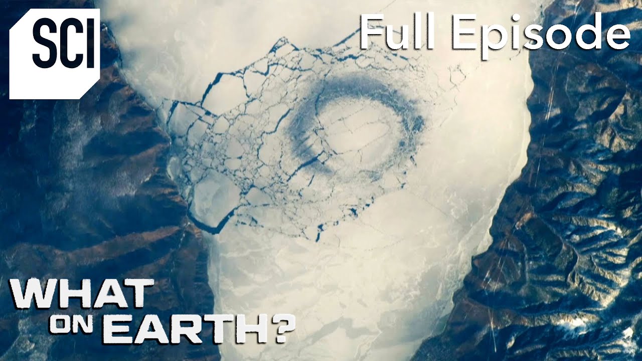
In April 2009, NASA astronaut Mike Barratt looked out the window of the International Space Station and photographed two enormous circular patterns carved into the frozen surface of Lake Baikal, the world’s oldest and deepest lake. The rings weren’t small — they stretched miles across, invisible from the ground but unmistakable from orbit. Science Channel’s What On Earth? traces how that single photograph turned a strange visual anomaly into a genuine scientific puzzle.
- Mike Barratt’s April 2009 photographs from the ISS first drew global attention to the ice rings, but satellite records show they’ve been appearing on Lake Baikal since at least 1969.
- The rings run roughly 5 to 7 kilometers (3 to 4.4 miles) across, with a dark band of thin ice ringing a brighter, thicker center — and they’ve caused vehicles to break through the ice near Nizhneye Izgolovye Cape.
- Researcher Alexei Kouraev’s field and satellite studies ruled out geothermal gas venting as the cause, since the rings also form over shallow water and on other lakes, including Mongolia’s Lake Hovsgol and Russia’s Lake Teletskoye.
A Ring Photographed From Orbit
Barratt’s April 2009 images weren’t the first evidence of the phenomenon — they were just the first to make people pay attention. Satellite archives going back to 1969 show dozens of similar rings forming on Lake Baikal, almost always in March and April, right as the lake’s ice cover thins toward spring breakup. The scale is what makes them impossible to spot without an orbital vantage point: at 5 to 7 kilometers across, a person standing on one edge of a ring couldn’t see the other side, let alone recognize the shape.
Each ring shows the same signature: a dark perimeter of thin ice wrapped around a noticeably brighter, thicker center. From above, they look almost engineered — perfect circles stamped into a frozen surface that covers roughly 20 percent of the world’s unfrozen freshwater. That clean geometry is exactly what made the rings so hard to explain and so easy to speculate about.
A Real Hazard on a Frozen Highway
Lake Baikal isn’t just scenery — locals drive across it in winter, and the ice rings turned that routine crossing into a gamble. The thinned, dark ice along a ring’s boundary can give way without warning, and vehicles have repeatedly broken through and sunk in these zones, with incidents concentrated near Nizhneye Izgolovye Cape. Because the rings can’t be seen or predicted from the ground, drivers have had no reliable way to know they were crossing one until the ice failed beneath them.
Satellite records stretching back to 1969 show dozens of these rings, each one 5 to 7 kilometers across — wide enough that nobody driving across the ice would ever see the shape they were standing on.
Ruling Out Gas and Aliens
The rings’ near-perfect circularity fueled every kind of speculation, from extraterrestrial activity to underground methane venting from gas hydrates on the lake bed. Researcher Alexei Kouraev led field and satellite work that dismantled the gas hypothesis piece by piece. Giant rings turned up over stretches of Lake Baikal too shallow to ever produce gas hydrates, and the same circular ice formations appeared on entirely different lakes — Mongolia’s Lake Hovsgol and Russia’s Lake Teletskoye — where no comparable gas venting exists. If the rings were tied to geology beneath one specific lake, they shouldn’t have shown up on lakes with completely different lakebeds hundreds of miles apart.
Warm Water Spinning Beneath the Ice
The actual mechanism turned out to be physical, not geological. Scientists traced the rings to warm, lens-shaped eddies of water rotating beneath the winter ice, likely set in motion during autumn by a combination of wind patterns, river inflows, and the underwater topography of the lake basin. These eddies spin clockwise, and the Coriolis force pushes the swirling warmer water outward toward the edges of the lens. That outward flow selectively melts and thins the ice directly above it, tracing out the well-defined circular boundary that shows up so clearly in satellite images — formations that can persist anywhere from a few days to several months before the ice refreezes or breaks up entirely.
The eddy mechanism is the same kind of natural process that keeps turning up in unexpected corners of the planet, not unlike the sudden geological surprises covered in Unusual ‘Lava Eggs’ Appear by Volcano or the collapsed formations explored in World-class sinkholes attract divers to South Australian farms — landscapes that look impossible until someone works out the physics underneath them. On Baikal, that physics is still being mapped ring by ring, season by season, one satellite pass at a time.









NYC Apartment Tour: $14 MILLION LUXURY APARTMENT
Why people are choosing to quit social media
The Quiet Life of the King of the Mountain
The Psychedelic Shamans Market of Peru
Roofing a Steep 45° Pitch! Barn Board Sheathing